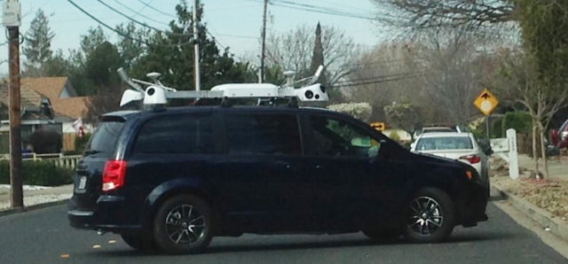
The mysterious Apple vans that have been spotted around the country are gathering data for an in-house Maps database, taking storefront photos, and collecting images for an upcoming 3D Street View feature, reports 9to5Mac. Sources say the vans are not test vehicles for an upcoming self-driving Apple car.
To launch Maps, Apple aggregated geography data from several third-party sources, including TomTom. The company is said to be working on replacing data from those sources with its own base map data. Initially Apple had planned to shift to its own in-house map database in 2017 but that may be running behind schedule and instead could happen in 2018.
Apple's vans are also collecting street view images; however, the company wants to display the images in a more intuitive manner.
To expand its 3D Flyover mode in Maps, Apple is working on ways to tie together its new camera data to make a street level version of 3D Maps for a future version of its Maps app. As Apple has only recently started collecting its 3D Street View data, such a feature is not likely to be imminent.
Finally, the vans are also taking still pictures of businesses along commercial roads. This initiative is codenamed "Project Gardar" and it aims to replace the Yelp images seen on business cards within the Maps app. Apple will reportedly roll out these images gradually within the next year.
In addition, Apple is working on other improvements to Maps that will ship alongside iOS 9, including a new transit directions feature which will initially launch in six cities.
We will likely learn more about Apple's plans for Maps during the WWDC 2015 keynote scheduled for June 8th.
Please follow iClarified on Twitter, Facebook, or RSS for updates.
Read More


